




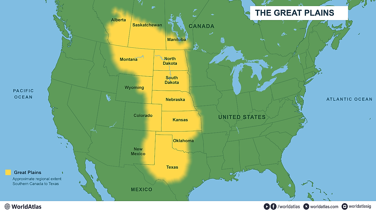
The Great Plains, which spans approximately 1.125 million square miles across the United States and Canada, is significantly larger than Western Europe. According to estimates, the total area of Western Europe’s nine countries, including France and Germany, measures around 428,000 square miles. This means the Great Plains could encompass all of Western Europe twice, with a remaining area roughly equivalent to the size of Texas.
Great Plains vs. Western Europe
France and Germany are the largest countries in Western Europe, while the other nations include Austria, Belgium, the Netherlands, Switzerland, Luxembourg, Liechtenstein, and Monaco. The area calculations do not include France’s overseas territories and take into account the country’s inland waters. If the area of Western Europe were doubled, it would still fall short by about 270,000 square miles compared to the Great Plains.
The United Kingdom and Ireland are classified under Northern Europe, and Spain and Portugal are in Southern Europe. Even with the United Kingdom added to the total area of Western Europe, the Great Plains would still outsize the combined areas significantly.
Geographical Extent
The Great Plains extend beyond the agricultural landscapes that are commonly associated with the region. They stretch to the Mackenzie River delta at the Arctic Ocean in Canada, incorporating vast grasslands that cross the U.S. border into Alberta, Saskatchewan, and Manitoba. The landscape transitions from grassland to mixed woodland and coniferous forest as you move northward.
In the United States, the Great Plains’ elevation varies from 2,000 to 6,000 feet above sea level as it approaches the Rocky Mountains. Precipitation is notably less in the western regions, with eastern Kansas receiving over 30 inches of rainfall annually, while areas near the Rockies see less than 15 inches.
Nebraska’s Sandhills and Other Features
A notable feature of the Great Plains is Nebraska’s Sandhills, which cover approximately 19,300 square miles, surpassing the Netherlands, which is about 16,000 square miles in size. The Sandhills are predominantly rangeland, with beef cattle production serving as the main agricultural activity. The area is home to nearly 2,000 shallow lakes and extensive wetlands that support various wildlife, including migratory birds and turtles.
Plateaus and Southern Great Plains
The Llano Estacado, found in western Texas and eastern New Mexico, covers about 32,000 square miles, comparable to Austria’s 32,400 square miles. Farmers in this region utilize irrigation from the High Plains aquifer system to cultivate crops such as cotton and grains.
Only portions of Texas are geographically categorized as part of the Great Plains, which encompasses around 269,000 square miles of the state. The combination of the Great Plains area, including parts of Canada and the U.S., is equivalent to nearly two Western Europes along with the entirety of Texas.
