




Hurricane Simon continued to pose a threat near the Mexican coast as it approached land on October 11, 2026, marked as a category 4 storm. The hurricane exhibited sustained winds reaching up to 250 kilometers per hour (155 miles per hour) while moving north-northwest.
At approximately 2:30 p.m. local time (20:30 Universal Time), Simon’s eye lay about 50 kilometers (30 miles) offshore, situated between Manzanillo and Puerto Vallarta. The Visible Infrared Imaging Radiometer Suite (VIIRS) on the Suomi National Polar-orbiting Partnership (NPP) satellite captured images of the hurricane at that time.
By then, the National Hurricane Center (NHC) reported that Simon’s sustained winds had decreased to approximately 210 kilometers (130 miles per hour). The storm’s inner core brushed against the coastal regions, with the Sierra Madre mountains appearing to mitigate some of the storm’s intensity and reduce its wind field size. Nevertheless, Simon was still delivering heavy rainfall and flooding to coastal towns, particularly in Manzanillo, increasing the risk of mudslides in nearby mountainous areas, as indicated by various news reports.
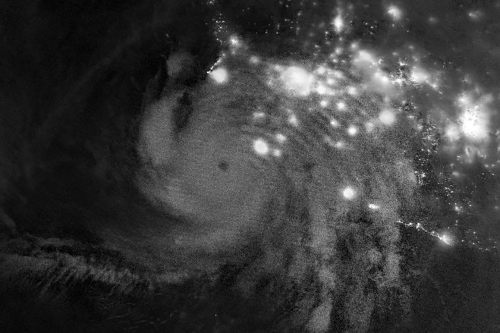
In the early hours of October 11, satellites visualized the storm’s impact extending into the upper atmosphere. A subsequent nighttime image, also obtained by the VIIRS on the NOAA-21 satellite, revealed atmospheric gravity waves emanating from the hurricane. Such ripples are produced when strong convection near the cyclone’s eyewall releases latent heat, causing tall cumulonimbus clouds and subsequent waves that can reach the stratosphere and mesosphere.
However, meteorologists noted that these atmospheric waves are often not easily observable due to upper atmospheric winds that can dissipate them before they manifest visibly. The VIIRS day-night band, sensitive to airglow, can detect these ripples; on the night the image was captured, minimal moonlight allowed the airglow to stand out.
As of October 13, forecasters were expressing low confidence regarding the storm’s intensity and trajectory, as Simon continued to evolve unpredictably. There were indications that the system might steer north and enter the Gulf of California before making landfall. In the upcoming days, hazardous nearshore conditions from large swells were expected along parts of Mexico’s southwestern and west-central coasts.
